

We’ve evolved the bike, not the rider
This is a sampling of some of our test routes and club rides. We will post more as time permits .. If you visit us, we suggest you download these ahead of time into your own GPS / Navigator
This is only a partial list, our full list of routes can be found here
Saturday rides No Drop / Sag for mechanical – health
8:00 start – 40 miles usually 1 or 2 groups 16mph & 18mph but if there’s not enough people (or they are not too enthusiastic) we will be at the 16mph page rolling average. ( 1 or 2 stops with bailout options at 20 and 30 miles)
8:30 start – 12-15 miles, 1 group at 10-12mph 1 stop
Due to CV19 we are recommending these groups do not paceline but ride side by side. Bring a mask for the stop if you plan on entering the store, water and tools + parts for basic mechanical (flat tire, etc) Have a SAG plan of your own, the store SAG can sometimes be caught between groups and take time to recover someone.
For the current route, please click the image to be taken to a download page

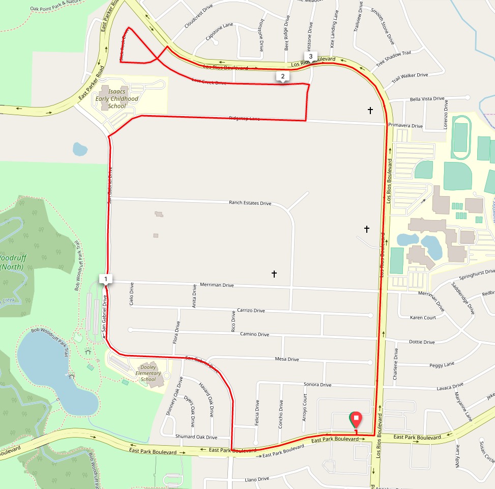
Course 001
This is a 5 mile “good traffic” route to the north of the store. There are no stops on this route
This route has is basically flat with only a few feet of elevation transition throughout the route
You can eliminate one mile of this route by continuing straight on Ridgestop Lane
You can eliminate 3.2 miles by turning right on Merriman Drive
Click here or the map to be taken to the RWGPS direct link or download the .FIT or .TCX her
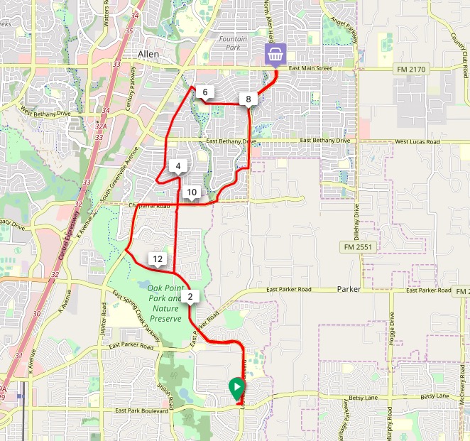
Course 002
This is a 14.7 “good traffic” route to the north of the store. It has one stop at mile 7 at a convenience store.
There are 2 pretty good climbs and some fast downhills on this route.
Click here or the map to be taken to the RWGPS direct link or download the .FIT or .TCX here.
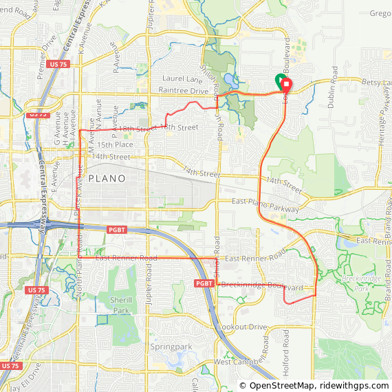
Course 003
This is a 13 mile “moderate traffic” route to the north of the store. There are no planned stops. This route goes through downtown Plano via K avenue and will have interaction with traffic in this area; though its downhill during this time and the typical interaction is friendly
There is 1 long steady climb around the 2nd mile – and 1 steep climb right near the end on Los Rios
Click here or the map to be taken to the RWGPS direct link or download the .FIT or .TCX here.
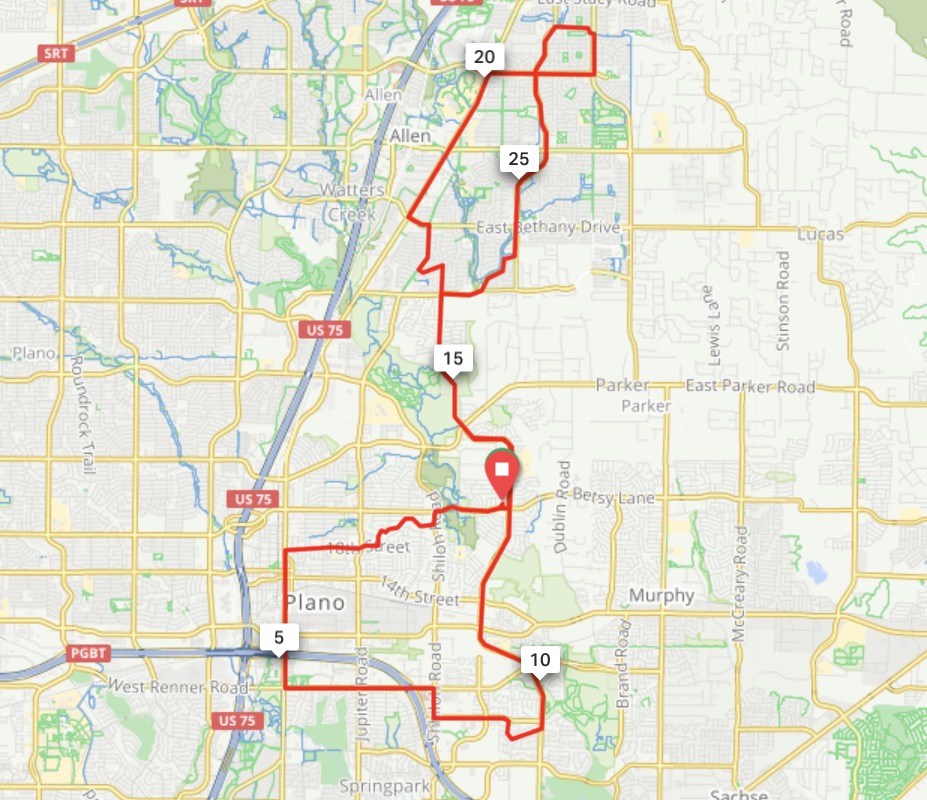
Tour De Plano
This is a 30 mile double donut route that goes through downtown plano and then on north though allen. It puts our little store right in the middle for use as a rest stop for water or other needs
There are a couple of climbs and some texture to the route.
Click the map to be taken to the RWGPS link, or download the various files from here
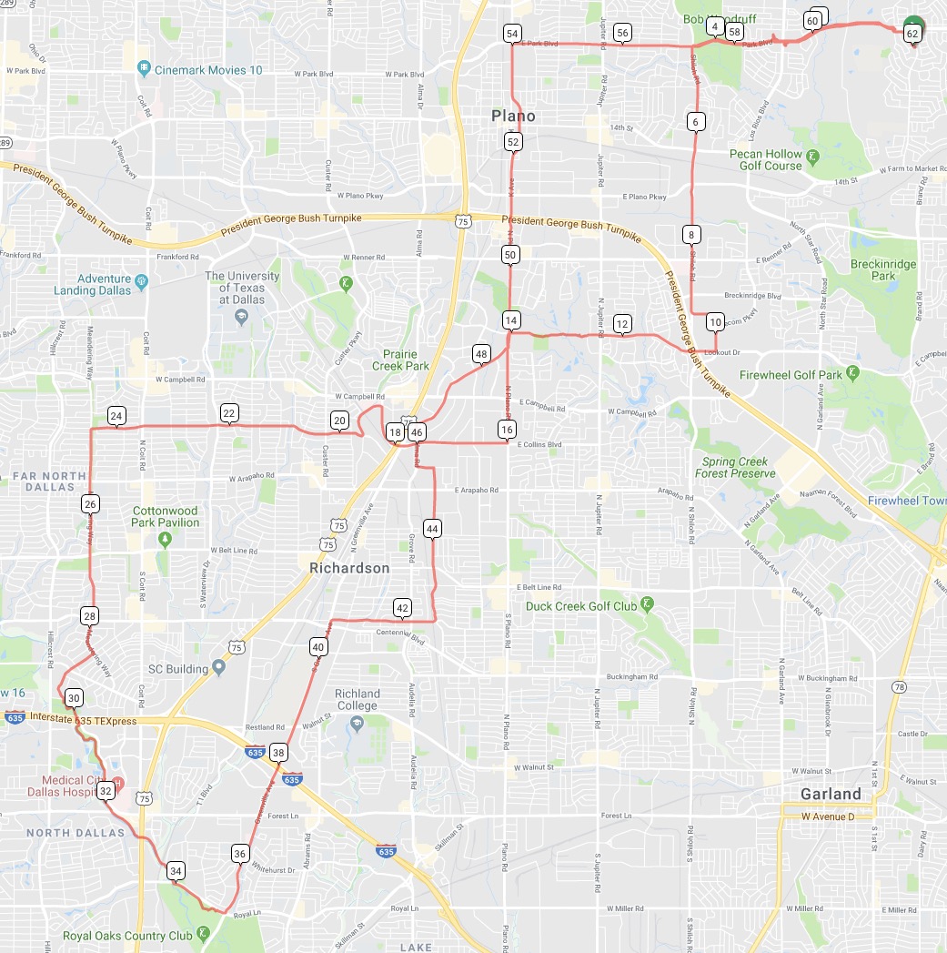
Tour De Richardson
Another 32 Mile loop going South / South West of the store and through medical city and parts of the famous(?) white rock trail
here are a couple of climbs and some texture to the route.
Click the map to be taken to the RWGPS link, or download the various files from here
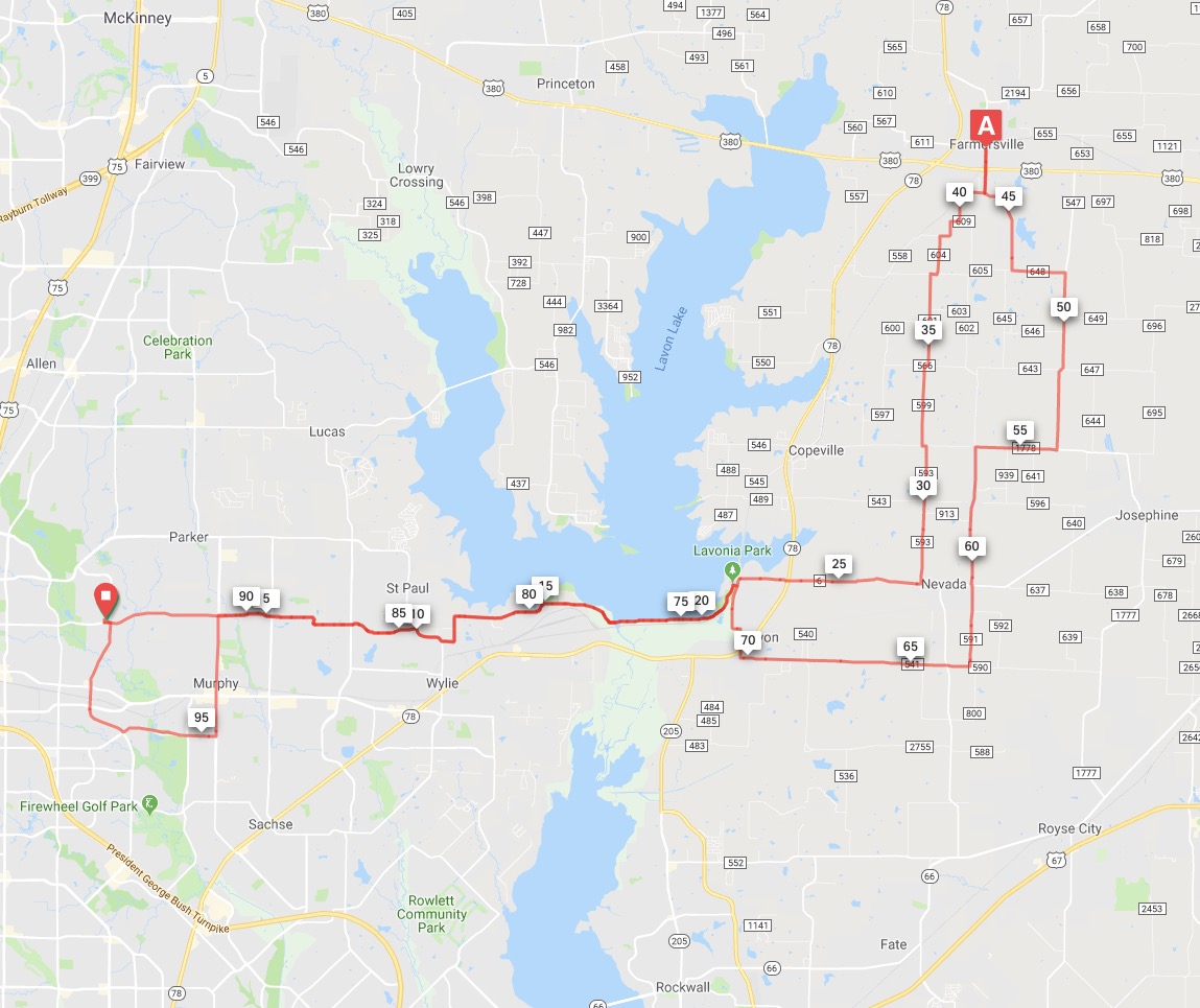
Farmersville in the farm
100km of farm and farm to market roads
here are a couple of climbs and some texture to the route.
Click the map to be taken to the RWGPS link, or download the various files from here